


Before a building can be designed properly, someone has to understand the site. Parcel boundaries, terrain, access, title context, overlays, constraints, services, and local conditions all shape what can happen.
The data often exists, but it lives across separate sources and formats. That makes early feasibility slower than it needs to be, and it pushes important site questions too far downstream.
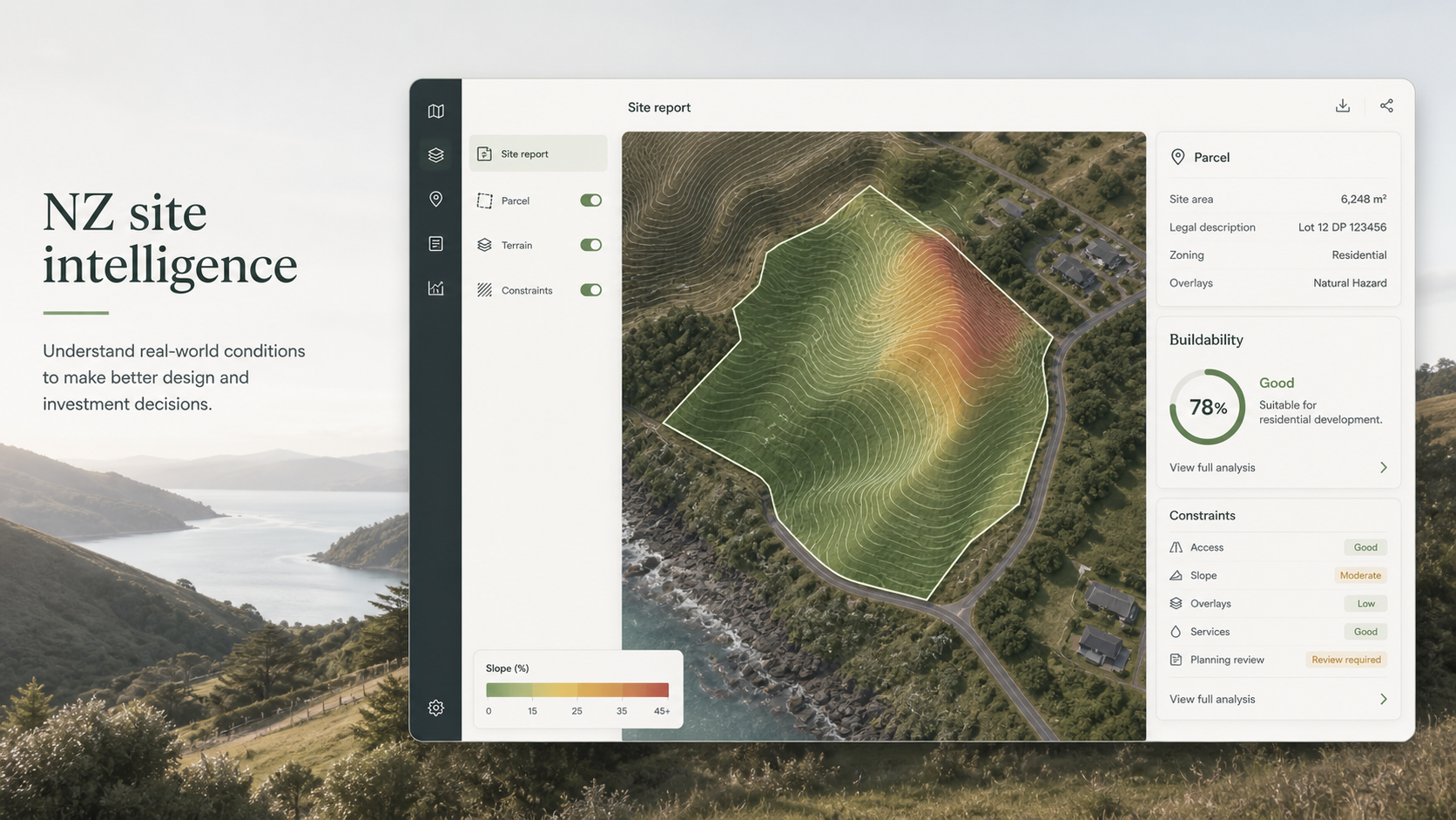
A workflow for integrating New Zealand land and property data into a practical buildability layer. The goal is to give builders, designers, and project teams the site context they need for early decisions.
The useful question is not just "where is this land?" It is "what does this site mean for the thing we want to build?"
- Pulls together parcel, terrain, property, and site-context data relevant to a project location.
- Normalises the data into layers that can be understood by people making building decisions.
- Highlights the checks that matter early: slope, access, constraints, overlays, and missing information.
- Turns raw site data into a report or interface that can sit inside a build workflow.
Earlier visibility of site constraints and fewer blind spots before committing design time. Teams get a clearer first pass on whether a site is straightforward, complex, or needs deeper review.
- NZ-specific data rather than a generic mapping layer.
- Building context sitting on top of land context.
- Designed for early feasibility, not technical GIS users only.